HOME / Software / Galaxy-Eye : Feature List
The group of functions of Galaxy-Eye takes advantage of 3D laser measurement data from various situations, including managing the construction progress, planning how to move equipment with new installations or modifications, examining layout, and creating CAD data on facilities.
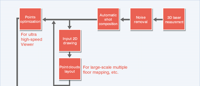

Several preprocessing steps are required to make use of data acquired from laser measurements.
Automation of complicated noise removal and shot composition has significantly reduced the necessary man-hours with preprocessing.
Automatic noise removal function
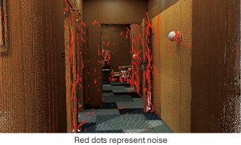
Floating points regarded as measurement noise are automatically extracted and removed from the point clouds.
This measurement noise must be completely removed in making more efficient use of data acquired from laser measurements. The automated processing of this complicated noise removal can drastically reduce the burden of preprocessing.
Automatic shot composition function
Galaxy-Eye employs a fully-automated process when composing several shots.
It can compose a shot containing the measurement data on 40 million points in around three minutes, thus significantly shortening the necessary man-hours.
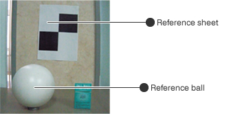
Any shot composition of measurement data that cannot be automatically composed can then be simply achieved by specifying reference values for the composition (three characteristic points, plane and ball).

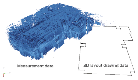
Point clouds layout
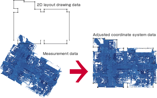
When 2D layout drawing data of a plan view,etc. already exists, the positions can beadjusted using the data as a reference.
Accordingly, work can be performed with the coordinate system along with the existing plan view, not only performing work with the coordinate system of the measurement data.
Since the floor level can be set arbitrarily, positions above the floor which used to be difficult can now be adjusted.
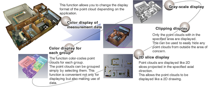
The simplest way of utilizing point cloud data is to visualize and confirm the data on the monitor.
Galaxy-Eye achieves extremely smooth visualization by drawing point clouds at extremely high speed. It also allows point cloud data to be quickly verified by selecting the display format of the point cloud depending on the application.
Walk-through and fly-through functions
These functions allow you to move around the point clouds via simple operation.
The walk-through function reveals the on-site status in detail by walking you around in the data while the fly-through function enables observation from the ceiling, from an outdoor position inside a building, or from other viewpoints from which are hard to observe in reality.

Point cloud display setting function
Ultra High Speed Viewer
This function allows for infinite data to be read with the unique high-speed data processing technology. Since the data can be readseamlessly, itcanbe handled smoothly even with data exceeding 10 billion points.

One way of making more efficient use of point cloud data involves simulations using the point cloud data.
We have developed a dimensional measurement function for identifying the size or length, an interference identification function for examining the moving of equipment, and a layout function for examining the arrangement of equipment and devices.
The use of a simulation function enables desktop examination of any problems at a measurement site.
Dimensional measurement function
This function allows the distance between two points and the angle made by three points to be measuredusing point clouds.

Interference check function
This func tion a llows any interference to be identified between the point cloud data and the shape data when moving through the specified route.
The interference point clouds change color, thus facilitating confirmation of any interference.

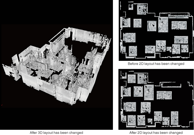
Layout function
This function allows layout to be examined by creating layout data from point clouds.
The layout can bevery easily changed via the mouse, thus allowing various layouts to be examined in a short period of time.
CAD Layout function
This function allows for design CADs to be laid out freely in the point clouds, by reading external CAD data.
Designs can be created using actual data, such as layout examinations on site, actualplacement and etc.
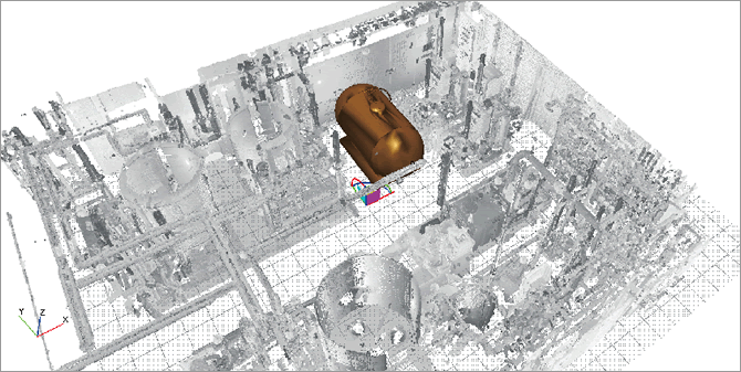
Video data creation function
This function allows you to output a video file (AVI) of a walk-through or interference check.
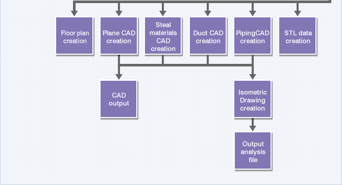
Modeling used to create shape data from the point cloud data is the most attractive function of the point cloud processing software.
For use in modeling plants we developed a function for use in creating CAD data on the major shapes (pipes, steel materials, and planes).
The modeling function can be used to acquireshape data based on the actual object.
Function to create CAD data on pipes (semi-automatic)
This function allows for the creation of CAD data on pipes from point clouds. It searches for a standard shape from the library that conforms to the point cloud, and then creates the appropriate standard shape. In addition, new standard shapes can be registered through editing the library.

Function to create CAD data on pipes (free creation)
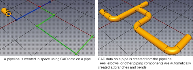
This function allows for the free creation of CAD data on pipes in space using CAD data on a given pipe. It creates the data without point clouds and thus complements sections from which measurement data has been successfully acquired.
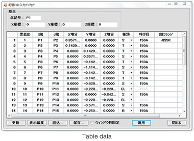
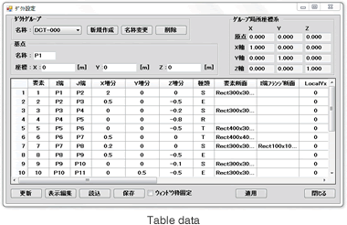
Piping CAD creation data table
Galaxy-Eye is not only for the modeling of shape data from poin t cloud data, but also allows for entry of data as table data. This function expands the range of applications, such as entry from design dimensions, examination of new designs and etc.
Isometric Drawing creation
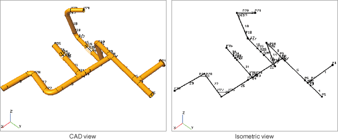
This function allows for the creation and output of isometric drawings based on the created piping CAD. All piping CAD models of Galaxy-Eye are controlled by the center line. Numerous convenient functions tied to analytical data are provided, such as setting the support position, automatic dimension output and etc. to the center line.

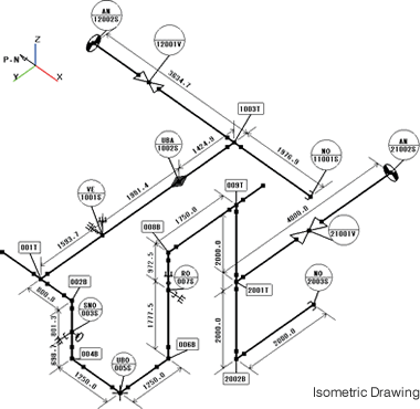
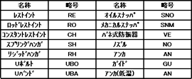
The isometric drawing function provides various functions, such as support creation, constraint condition settings, ID settings, automatic dimensional drawing creation between IDs and between supports, and a drawing function.
Function to create CAD data on pipes (fully-automatic)
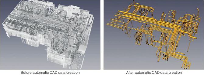
This function provides for fully-automatic processing of the creation of CAD data on pipes and planes. Parallel processing allows CAD data on large-scale point cloud data to be created in a very short time.
Function to create CAD data on steel materials
This function allows for the creation of CAD data on standard steel materials like angle and H-steel. Specify the steel material to be created from the library and use the CAD data on the steel material to compare it with the point cloud. New standard shapes can be registered through editing the library.

Duct CAD creation
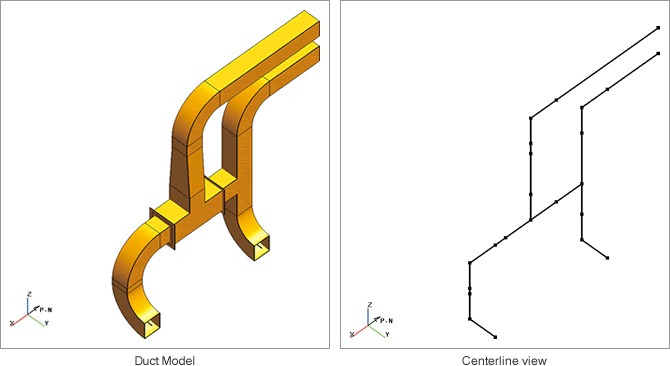
The duct creation function is for creating ducts by entering table data. Sectional shapes, constraint positions and etc. can be set freely, and also allows for displaying by center line, and creation of isometric drawings.
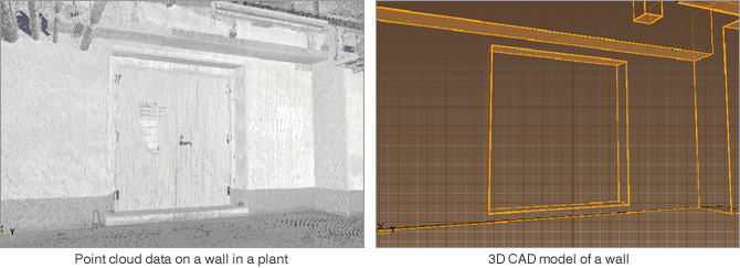
Function to create CAD data on planes
This function creates CAD data on planar sections like the floors and walls of buildings. It creates a planar shape that fits with the point cloud specified with the mouse.
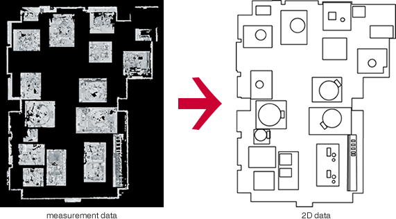
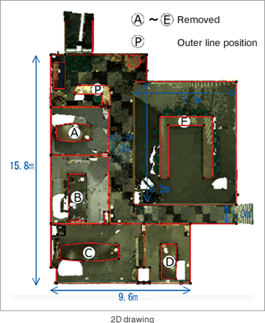
Floor plan creation
This function is for creating 2D drawings by tracing straight lines and curves on the point cloud data. Since the 2D data of a wall or equipment position can be easily created based on the measured point cloud data, it can be utilized for understanding the site conditions and the materials for planning.
CAD output function
Galaxy-Eye can output 3D models in the following formats
| File format | Description |
| DXF | Compatible with various types of CAD software, including Auto CAD® |
|---|---|
| DGN | Format to retain CAD data for MicroStation® |
| IGES | Intermediate file format used for data exchange between different types of CAD software |
| STL | General-purpose file format that represents 3D shapes with triangles |
Software products /
Feature List /
Recommended specifications
Automatic pipe CAD modeling Option /
Sample analysis applications /
Product seminars


